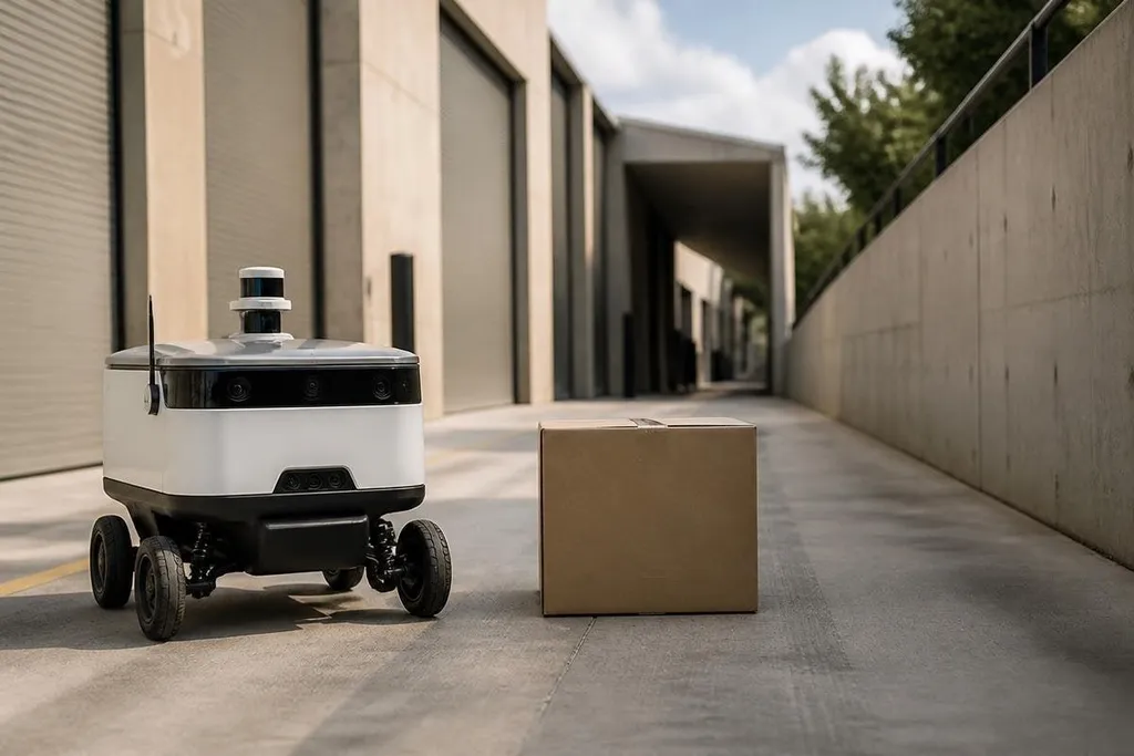
Strong motors and accurate sensors still won't stop a robot from taking the wrong route around a box. Navigation asks the system to know where it is, understand what surrounds it, choose a safe path, and keep moving when the scene changes.
For anyone judging an autonomous system, that makes navigation the part worth checking before the arm, battery, or software demo.
Quick read
- Sensors give the robot pieces of the scene, not a complete map.
- Wheel slip, moving people, poor lighting, and blocked routes can break its position estimate.
- A useful navigation test runs for long enough to expose recovery failures.
Localization comes first
Navigation starts with localization: the robot estimates its position inside a map or work area. A camera may see a wall, while LiDAR measures the distance to nearby surfaces. Neither sensor knows the robot’s position by itself.
The system compares new sensor readings with earlier readings. A system using simultaneous localization and mapping, or SLAM, builds a map while it estimates its own movement through that map. The two jobs affect each other. A bad position estimate can place a wall in the wrong location, while a poor map can send the position estimate further off course.
This becomes harder in a warehouse with long, similar aisles. The robot may see the same shelves at several points in its route, so it needs more than one visual clue to tell those places apart. A map can also become stale when pallets move, doors close, or equipment changes position.
Sensors see different parts of the problem
No single sensor gives a robot a full view of its surroundings. LiDAR can measure distance well, but a flat surface may tell it little about where it is. Cameras carry color and shape information, but glare, darkness, dust, and a changed viewpoint can affect what the robot sees.
Wheel encoders measure how far the wheels have turned. That estimate drifts when a wheel slips on a smooth floor or crosses a cable cover. An inertial measurement unit tracks changes in motion, yet its estimate also drifts over time.
Navigation software combines these inputs through sensor fusion. In plain terms, it weighs several imperfect measurements instead of trusting one reading. The robot still needs a way to notice when those readings disagree, then slow down, stop, or ask for help.
A clear path can disappear
A planned route is only useful while the route remains open. A mobile robot may plan around a fixed shelf, then meet a person, cart, or box in the same space. The local planner must react without cutting too close to the obstacle or freezing whenever the scene changes.
Speed makes that decision harder. A robot moving faster needs more distance to stop, while a narrow aisle leaves less room to turn. A safe system sets limits for speed, turning, stopping distance, and the size of objects it can detect.
Recovery matters just as much. If its position estimate becomes uncertain, the robot might return to a known marker, ask for a new route, or stop in a safe place. A demo that shows a clean trip says little about what happens after the first blocked path.
A blocked route tells you more than a clean run. It shows whether the robot can update its map, slow down, and recover its position. Robot24.com reports on named machines and deployments, so the cases below can be judged by what the robot did after the path changed.
Why the hardest cases happen outside the lab
A lab can keep lighting, floor texture, object placement, and traffic under control. A working site cannot. Sunlight may enter through a door, a forklift may block a route, and a worker may stand where the map expects open space.
The robot must also handle the cost of failure. A wrong turn in a research test may waste time. In a warehouse, it can block a lane or delay a task. In a hospital, a navigation error can affect people moving through shared space.
I’d judge a navigation system by its recovery after a mistake, not by its cleanest run.
Test that recovery with a moved object, a blocked sensor, a surface that causes wheel slip, crossing traffic, and a low-confidence position estimate. Record whether the system updates its map, slows down, stops, requests help, or chooses a new route.
Before you approve a robot for a site, ask for evidence that matches the work it must do:
A buying check for autonomous navigation
- Map source: Does the system use LiDAR, cameras, floor markers, GPS, or a mix?
- Position limits: How does it report uncertainty, and what action follows?
- Route recovery: What does it do after a blocked path or failed localization?
- Site changes: Can staff update maps without sending the robot back to the maker?
- Safety limits: What speed, stopping distance, and obstacle size has the maker tested?
- Operating record: Can the supplier show runs in a site with similar traffic and lighting?
Reaching one destination once is a small test. Keeping a useful position estimate, choosing a safe route, and recovering after change answers the harder question.
Until a supplier shows that behavior in the place where you plan to work, navigation remains a claim to check, not a box to tick.